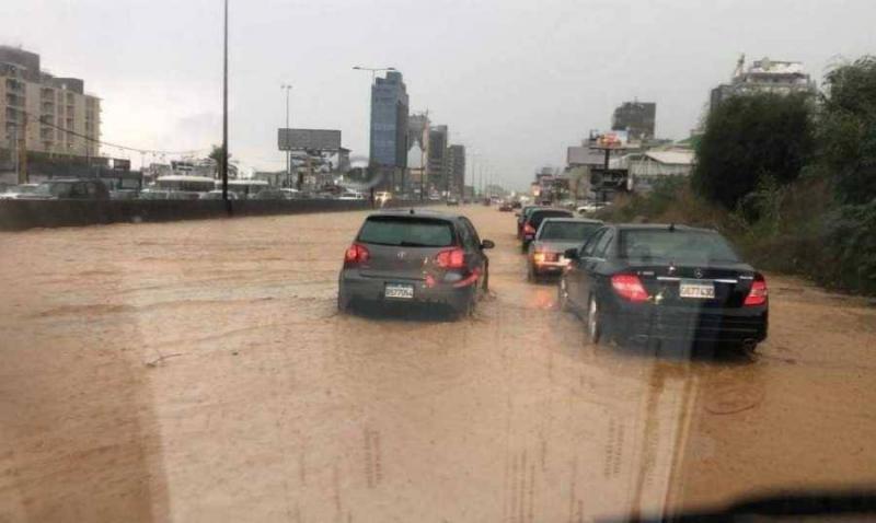
With every rainfall, citizens endure the same challenges on the roads of Lebanon, which turn into swamps and mobile puddles. Due to the decay of the state and its collapse by the political system's will, winter becomes a nightmare, especially for those who unfortunately find themselves on the roads heading to their workplaces, universities, or any other necessary destinations, or returning home. They may be stuck for hours in traffic jams as the roads—especially the coastal ones—transform into swamps and flowing rivers that hold them captive, or cause their vehicles to breakdown due to water leaking into their engines, not to mention the risk of being swept away by flash floods, as happened yesterday on the Romiehn-Nahr al-Mout road.
Some scenes from last night repeated this morning, especially on the Jounieh-Beirut highway, where the Traffic Control Room announced the accumulation of water, leading to severe traffic congestion. The information reported includes:
- The Sidon-Beirut highway is currently passable in both directions.
- Water accumulation in the Fish Market area, Karantina, with no traffic stoppage.
- The Deir El Qamar and Terchich-Zahlé roads are open to all vehicles.
- Water accumulation on the Jounieh highway, with heavy traffic in the area.
- Traffic is completely stopped from the Bcharré Bridge to Tabarja along the Jounieh highway due to flooding and water accumulation.
- Traffic is heavy on the Shweifat road at the Lebanese University intersection.
Meanwhile, the mountainous roads are cut off due to snow accumulation: Ainata - Arz, and Kfarzabian - Hadath Baalbek.
Father Eli Khneiser, a specialist in weather conditions and climate, reported that the low-pressure system began to affect Lebanon since last night with thunderstorms and torrential rains along the coast and mountains, where the intensity of thunderstorms and lightning increased at night, with a high rate of precipitation leading to torrents and rising water levels on the roads. He added: "The activity of torrential rain will continue today, Wednesday, especially in the afternoon and evening until dawn on Thursday (both coastal and mountainous), and on Friday afternoon and evening, continuing until Saturday morning."
Lebanon and the eastern Mediterranean basin are affected by a low-pressure system centered south of the island of Crete, accompanied by heavy intermittent rains, thunderstorms, and active winds, with a drop in temperatures returning to seasonal rates, continuing until Thursday afternoon, where it will gradually recede. It is also expected that Lebanon will be affected by a quick low-pressure system accompanied by relatively cold air masses, centered over Italy, starting Friday evening until Saturday afternoon, when the weather will gradually stabilize.
**Today's weather forecast:**
- **Wednesday:** Generally cloudy with thick fog in the mountains that may worsen visibility at times. Temperatures will drop significantly, returning to seasonal averages. Scattered rain with sometimes heavy intensity, accompanied by thunderstorms and active winds reaching up to 60 km/h, with a possibility of hail, and snow expected at altitudes of 2100 meters during the day, possibly dropping to 1900 meters at night.
- **Thursday:** Generally cloudy with fog in the mountains and stable temperatures on the coast, with slight increases in the mountains and inland. Scattered rain will be heavy at times during the morning, accompanied by thunder and lightning, with snow starting from 2000 meters, with rain intensity easing from the afternoon and gradually diminishing overnight.
- **Friday:** Partly cloudy with medium and high clouds, temperatures will rise, and fog will form in the mountains. It will gradually turn cloudy starting from the evening with scattered rain, becoming heavy at night with thunderstorms and active winds reaching up to 60 km/h, and snowfall expected at 2000 meters.


