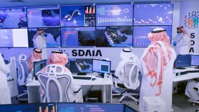
The Saudi Data and Artificial Intelligence Authority (SDAIA) provides a number of smart solutions to support developmental areas in the Kingdom by leveraging data and artificial intelligence technologies. This initiative supports national efforts aimed at preserving the environment and natural resources, reaching a sustainable future, and achieving the objectives of Saudi Vision 2030. This aligns with SDAIA's role as a national reference for data and artificial intelligence in terms of organization, development, and management.
These efforts are consistent with parallel initiatives undertaken by SDAIA to enhance the Kingdom's position as a leader in data and artificial intelligence, enable investment and innovation, develop technical infrastructure, and encourage the adoption of artificial intelligence in priority areas that serve national interests. SDAIA has dedicated its efforts to establishing a Center of Excellence for Artificial Intelligence in Environment, Water, and Agriculture in partnership with the Ministry of Environment, Water, and Agriculture. This center aims to innovate sustainability solutions and applications using artificial intelligence in these sectors.
The center's goal is to build a data lake that contains geographical information data and global satellite imagery from the last thirty years, and to prepare studies and research to serve the environment, water, and agriculture sectors using artificial intelligence. Additionally, it seeks to provide expertise to offer artificial intelligence solutions across various use cases, work with historical, real-time, and future data, build and train national capacities, and share knowledge in all artificial intelligence techniques and tools. Moreover, it aims to create sustainable use cases and solutions to assist the environment, water, and agriculture sectors in providing data analytics easily.
From the center's efforts, an initial life model was innovated based on artificial intelligence algorithms that reads nine historical land data points to determine their correlation with vegetation cover change indices and accurately predicts changes over the next six years with an accuracy exceeding 90%. The center has also presented a set of use cases contributing directly to combating the effects of climate change, forecasting desertification, and increasing vegetation cover to build a vibrant community with a healthy lifestyle while enhancing the aesthetic aspects of the Kingdom. Additionally, it has created a dashboard on vegetation cover changes in the Kingdom containing 6 billion data samples from the NDVI index monitored from 1984 to 2023, categorizing land into six types using satellite images.
The center has also launched the "Smart Planet Program," which is a smart Earth data platform that uses its historical data to build predictive algorithms and design several initial solutions for artificial intelligence algorithms to be shared with reserves and the Ministry of Environment, Water, and Agriculture. This aims to find innovative solutions to exploit and sustain untapped resource potentials, detect changes in vegetation cover, monitor agricultural crops, and observe changes in water bodies.
To find solutions to various challenges using artificial intelligence technologies, the Ministry of Energy, in cooperation with SDAIA, announced the launch of the Artificial Intelligence Center for Energy to leverage artificial intelligence in supporting initiatives in this developmental sector and contribute to achieving the objectives of the Saudi Green Initiative in reducing carbon emissions. The center plays a pivotal role in developing artificial intelligence and modern technologies in the energy sector, bringing together digital technology experts and energy experts in one team, and has worked on developing a clear methodology to prioritize artificial intelligence solutions.
In a related context, SDAIA monitors afforestation and green areas in Riyadh through the National Smart Cities Platform using satellites to build and train artificial intelligence models and process data to present a visual representation of green area locations in Riyadh, including the proportion of green areas relative to the total area. Additionally, it establishes indicators for the top neighborhoods in the green space index and builds an index measuring the proportion of green spaces within the neighborhoods of Riyadh and Al-Diriyah, as well as providing a tool on the National Smart Cities Platform specifically for displaying and monitoring the levels of green spaces.


