

The Meteorological Department of the General Directorate of Civil Aviation forecasts that the weather tomorrow will be partially cloudy to cloudy, with a slight increase in temperatures during the day. Scattered rain will occur, intensifying at night in northern areas, accompanied by active winds reaching speeds of up to 55 km/h and a possibility of lightning and thunder in the afternoon. Snow will fall at an altitude of 1300 meters. Fog will persist in high areas, and ice will form in the interior and on mountains in the early morning due to low temperatures, with warnings of slippery roads.
The following is stated in the report:
- General Condition: The effects of storm "Farah" will continue to affect Lebanon and the eastern basin of the Mediterranean, accompanied by heavy rain and snow and sometimes severe polar cold winds. Its impact will relatively lessen today (Thursday) and gradually intensify from Saturday morning, peaking on Sunday and Monday, where heavy flooding may occur at times.
- Warning: There is a risk of flying billboards, solar panels, and flooding, along with difficulties on mountain roads during Saturday and Sunday as storm "Farah" renews.
**Temperature Average for February**: 11.4 to 19.2 degrees.
**Expected Weather in Lebanon**:
- **Thursday**: Partly cloudy to occasionally cloudy with low morning temperatures. Scattered rain with light snow above 1100 meters and active winds intensifying up to approximately 80 km/h in northern areas. Widespread clear intervals are expected during the day. Dense fog will form in high areas, severely reducing visibility.
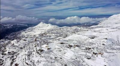
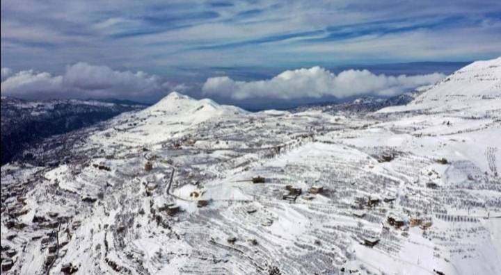
- **Friday**: Partly cloudy to cloudy, with a slight increase in temperatures during the day. Scattered rain will intensify at night in northern areas, accompanied by active winds reaching up to 55 km/h, with a possibility of lightning and thunder in the afternoon. Snow will also fall at an altitude of 1300 meters. Fog will continue in high areas, and ice will form in the interior and on mountains in the early morning due to low temperatures, with warnings of slippery roads.
- **Saturday**: Generally cloudy with the beginning of renewed low pressure system "Farah," leading to heavy scattered rain, accompanied by lightning, thunder, and winds active at 60 km/h, occasionally intensifying to about 85 km/h especially in the north by evening. There are warnings of flooding, and temperatures will remain low with snow starting from 1100 meters and below in northern and interior areas. The intensity of rain and snow will decrease at night, but will return to intensity starting from Sunday morning.
- **Sunday**: Generally cloudy with heavy scattered rain, accompanied by lightning, thunder, and active winds at 60 km/h, which may intensify to about 90 km/h in the morning and evening. There are warnings of severe flooding. Temperatures will remain low, with snow starting from 1100 meters and below in northern and interior areas. Dense fog will continue in high areas, severely reducing visibility.
**Temperatures**:
- Coastal: 8 to 15 degrees
- Mountainous: 3 to 5 degrees
- Interior: 4 to 5 degrees
**Surface Winds**: South-western at speeds between 20 and 50 km/h, occasionally intensifying to 80 km/h in northern areas.
**Visibility**: Generally poor due to fog in high areas.
**Relative Humidity on the Coast**: Between 65 and 95%.
**Sea State**: Rough to very rough (exceeding 4 meters), Sea surface temperature: 19 degrees.
**Atmospheric Pressure**: 765 mm of mercury.
**Sunrise**: 6:35 AM
**Sunset**: 5:09 PM