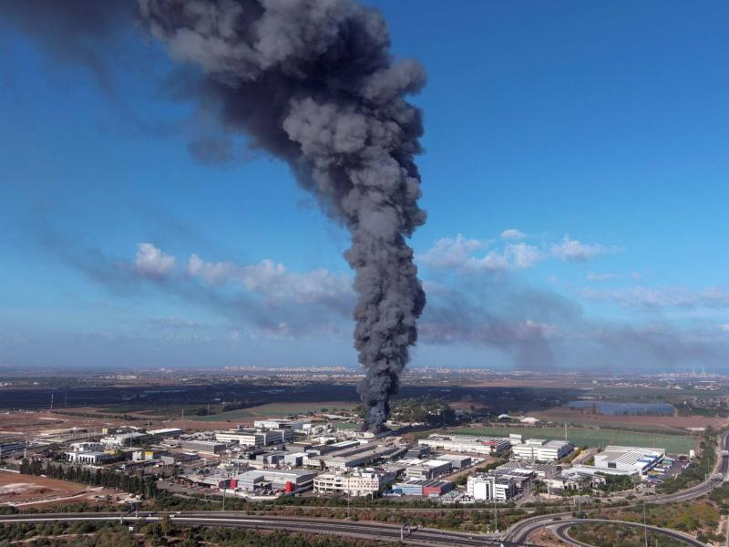
The Israeli presence in Gaza ended in 2005 after Israeli forces withdrew from the area and evacuated all Israelis, establishing a buffer zone between the enclave and areas controlled by Israel following the evacuation of 25 Israeli settlements within the territory. However, Israel maintained several communities along the border adjacent to this buffer zone. These communities, known as the "Gaza Envelope" or in Hebrew "Givot Gaza," consist of around 50 towns, which gained prominence after Hamas launched a comprehensive assault on Israel on October 7, leading to hundreds of casualties according to Israeli media.
The importance of the Gaza Envelope towns lies in their proximity to the buffer zone, making them the first line of defense for Israel against Gaza, which is controlled by Hamas. The geographical location of the envelope is crucial, as many towns in this area have faced violent attacks resulting from Hamas's offensive dubbed "Al-Aqsa Flood." Additionally, a large number of Israeli residents living in these towns have suffered severe damages ranging from deaths to injuries, with many taken hostage.
The area also holds military significance, as images and videos documented Hamas militants storming Israeli military sites in northern "Gaza Envelope," according to Israeli newspaper "Yedioth Ahronoth." Israeli army spokesman Daniel Hagari stated that the army evacuated residents from the Gaza Envelope towns. Israel has divided the Gaza Envelope into three local councils: Eshkol, Ashkelon, and Sha'ar HaNegev. The Eshkol local council includes 32 Israeli towns and spans an area of 380 square kilometers. The Ashkelon local council covers 175 square kilometers and contains four Israeli towns. The Sha'ar HaNegev council extends over 180 square kilometers and includes 11 Israeli towns.
The total population of the Gaza Envelope towns across the three councils is about 37,000, distributed as follows: 13,000 in the larger Eshkol council, 17,000 in the Ashkelon council, and 7,000 in the Sha'ar HaNegev council. Several towns in the Gaza Envelope have borne the brunt of the destruction caused by Hamas's attack on the adjacent Israeli towns close to the buffer zone, including Zikim, Sderot, Nahal Oz, Kissofim, and Eshkol. The surprise attack by Hamas also inflicted significant damage on Israeli military bases.
**Re'im Military Base** is known as the "Gaza Division Command Center," encompassing a substantial military force formed from all Israeli military branches, situated near an armored base. Its primary mission is to secure the entire border with Egypt from eastern Rafah to the Sudanese border, reaching the settlement of Zikim within Israel.
**Be'eri Settlement** witnessed hours of clashes between attackers and the Israeli army, where militants took 50 Israeli settlers hostage, resulting in numerous fatalities and injuries in its streets. This settlement was a "kibbutz," a socialist settlement established before 1948 among 11 agricultural kibbutzim in the northwestern Negev bordering Gaza. After 1948, its location shifted southwest in the Negev Desert, evolving into one of the wealthiest Israeli settlements in the region with a population nearing 1,000 settlers.
**Sderot Settlement** is the largest in the "Gaza Envelope," situated about 1.5 kilometers from the Gaza Strip. It was established on the land of the Palestinian village of "Najd" after 1948 and has transformed into a city housing over 19,000 settlers.
**Sofa Settlement** is the closest to Gaza from the southern side, located northeast of Rafah, marking it as the first station during the "Al-Aqsa Flood" operation.
**Karem Abu Salem** is described as the most fortified site, functioning as a "kibbutz" very close to Gaza, just 300 meters from the border between Gaza, Israel, and Egypt, serving as a strategic border crossing for the three areas. It was established after the occupation of the West Bank and Gaza in 1967, housing 13 settler families and Israeli military camps.
**Kissufim Settlement** is also located near Gaza, less than 2 kilometers away. Established in 1951 in the northwest Negev Desert, it became part of the settlement bloc Israel built, "Gaza Envelope." Years ago, Israeli authorities built shelters in each house to protect residents from Palestinian resistance rockets. However, despite the presence of these shelters, many settlers were killed or captured during the recent operation.
**Nahal Oz** is highlighted during this operation as one of the first sites taken by the resistance, being an agricultural "kibbutz" founded in 1951, less than a kilometer from Gaza, located in the northern Negev Desert near the Gaza border. It previously served as the site for a notorious incursion by the Palestinian resistance.
**Kfar Aza** is a settlement located about 5 kilometers east of Gaza, between the settlements of Netivot and Sderot, which was fully controlled by the resistance during the "Al-Aqsa Flood" operation.
**Kiryat Gat** is an Israeli settlement established in 1954, located 45 kilometers from Gaza, near the depopulated Palestinian villages of "Al-Faluja" and "Iraq al-Manshiyya." It housed a significant number of settlers after the Russian immigration to Israel in 1991, with around 60,000 settlers currently residing there, alongside a high-tech electronics factory.
**Kiryat Malachi** was established in 1951 on the land of the village of "Qastina," located on the main road between Magdiel and the Jerusalem-Jaffa road, which was depopulated and destroyed by the Israeli "Givati" Brigade in 1948.
**Beit Hanoun "Erez" Crossing** is a designated pedestrian crossing, used for transporting sick and injured individuals for treatment in Jordan, Israel, or the West Bank. Diplomats, foreign missions, journalists, Palestinian workers, traders, and others with crossing permits pass through it to Israel.
**Zikim and Ofakim**: The settlement of "Zikim" is one of the prominent settlements in the "Gaza Envelope," located on the northern border of the Gaza Strip, housing a military base overlooking the beach, considered one of the most secure due to its oil refinery and power station supplying electricity to southern Israel. Additionally, the settlement of "Ofakim" was targeted during the "Al-Aqsa Flood," located 16 kilometers from the Gaza Strip, and deemed outside the "Gaza Envelope."
**Palestinian Authority and the Gaza Strip**: The Palestinian Authority entered the Gaza Strip in 1994 under the Oslo Accords to begin applying Palestinian self-rule in Gaza and Jericho. Then Israeli Prime Minister Ariel Sharon proposed a disengagement plan from Gaza in 2004, which entailed evacuating settlements in the sector and a complete withdrawal, a plan approved by the Knesset nearly a year after its proposal. Israeli forces indeed withdrew from Gaza and evacuated 25 settlements housing approximately 8,500 people, marking the end of Israeli settlement presence with the declaration of military rule cessation there by 2005.


