The Israeli economy has faced a new blow due to the restrictions imposed on Israeli maritime trade by the Yemeni Houthi group. Starting with targeting Israeli ships, the attacks have expanded to include all vessels carrying goods and oil to Israel, causing significant financial losses and severely impacting maritime trade to and from the country. According to the Israeli maritime trade sector, as reported by the newspaper "Haaretz," "no container of goods has reached 'Israel' by sea for two weeks, and we expect this to continue for the next four weeks."
Ships heading to Israel are now forced to take a much longer route around the Cape of Good Hope; specifically, the journey stretches from 2,000 kilometers between Bab-el-Mandeb and the Gulf of Aqaba to 22,000 kilometers by detouring around the Cape of Good Hope, passing through the Atlantic Ocean and the Mediterranean Sea to the Port of Ashdod. Economically, this additional maritime distance translates into rising shipping and insurance costs, as the travel time from Asian ports can extend to fifty days instead of just one week via Bab-el-Mandeb through the Red Sea.
The Bab-el-Mandeb Strait is one of the most significant straits in the world, through which approximately 15% of global trade passes, involving more than six and a half million barrels of oil daily, and accounting for over seven percent of total oil trade. More than 22,000 vessels transit through it annually.
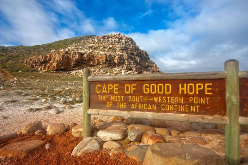
The Cape of Good Hope is a land promontory in the African continent near Cape Town, extending into the Atlantic Ocean, resembling a convex headland. It was once a common passage for commercial vessels traveling to and from Asia. There is a common misconception that the Cape of Good Hope is the southernmost point of the African continent and separates the Atlantic and Indian Oceans; however, it is actually located 150 kilometers (90 miles) west of this point, which is referred to as Cape Agulhas.
Geographically, the Cape of Good Hope is located southwest of South Africa, 140 kilometers away from Cape Town and 2.3 kilometers from Cape Point. The area surrounding the Cape of Good Hope and Cape Point offers stunning natural vistas.
The Cape of Good Hope is known to many Arab, Chinese, and Indian sailors, but it was first named and described geographically by the Portuguese explorer Bartolomeu Dias on June 5, 1488. He named it the "Cape of Storms" due to the frequent storms encountered there. The name "Cape of Good Hope" was given by King John II of Portugal to express his delight at discovering a sea route to India, which spared Europe from using the perilous overland caravan routes.
This discovery was one of the main reasons for the collapse of the Mamluk state as it shifted global trade routes towards the new maritime pathways instead of through the Heartland, which was referred to as the Old World. The Arab traveler Ibn Majid assisted Vasco da Gama in navigating to and beyond this cape, providing him with maps created by explorers, travelers, and Muslim scholars since the days of the Islamic conquests.


